
Satellites flying overhead in Earth’s orbit largely provide a two-dimensional view of our planet, but a Florida-based company is hoping to change that by using satellites to routinely build 3D maps of Earth’s entire surface.
Read more…
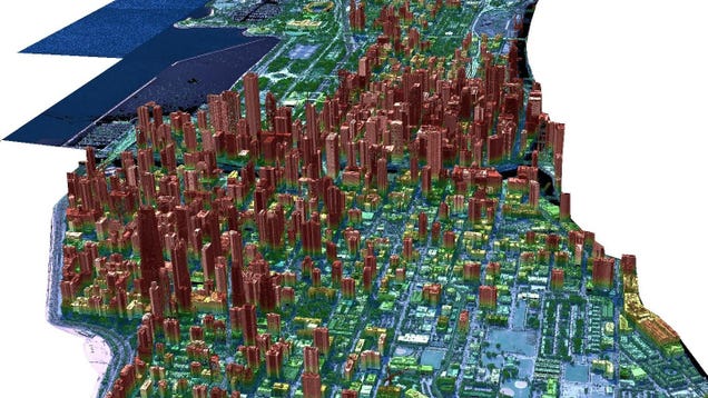
Satellites flying overhead in Earth’s orbit largely provide a two-dimensional view of our planet, but a Florida-based company is hoping to change that by using satellites to routinely build 3D maps of Earth’s entire surface.
Read more…